OpenLayers
mehr als nur Karten im Web
Andreas Hocevar, w3geo
Marc Jansen, terrestris
FOSSGIS 2024 | 22. März 2024 | Hamburg
Vorschau
- Kurze Vorstellung
- Einordnung
- Projektgeschichte
- OpenLayers im Browser
- OpenLayers ohne Browser
- Ausblick
Andreas Hocevar | w3geo
- Geschäftsführer w3geo
- Derzeit aktivster OpenLayers Entwickler
- Proj4.js, ol-mapbox-style, geotiff.js …
- Geospatial Expert
- JavaScript Entwickler aus Leidenschaft
Marc Jansen | terrestris
- Geschäftsführer terrestris
- Kernentwickler & PSC OpenLayers
- z.B. react-geo, SHOGun, GeoStyler
- Sprecher & Trainer
national & international - OSGeo Foundation Charter Member
Einordnung
- JavaScript, Open Source, aktive Community
- Governance durch die OSGeo Foundation
- Ähnliche Produkte: Leaflet, Mapbox/MapLibre GL
- Unterschied: Basiert auf Konzepten und Funktionen der Geoinformatik
- Daher: größerer Funktionsumfang, aber schwerer zu lernen
Projektgeschichte

- Ursprünglich entwickelt 2005 von MetaCarta, als Alternative zu Google Maps
- 2006: Open Source, "BSD-3-Clause-Clear" Lizenz
- 2008: Standard "BSD-2-Clause" Lizenz
- 2012: Neuentwicklung OpenLayers 3.0
- 2024: OpenLayers 9.0 – gereift, aktiv, aktuell
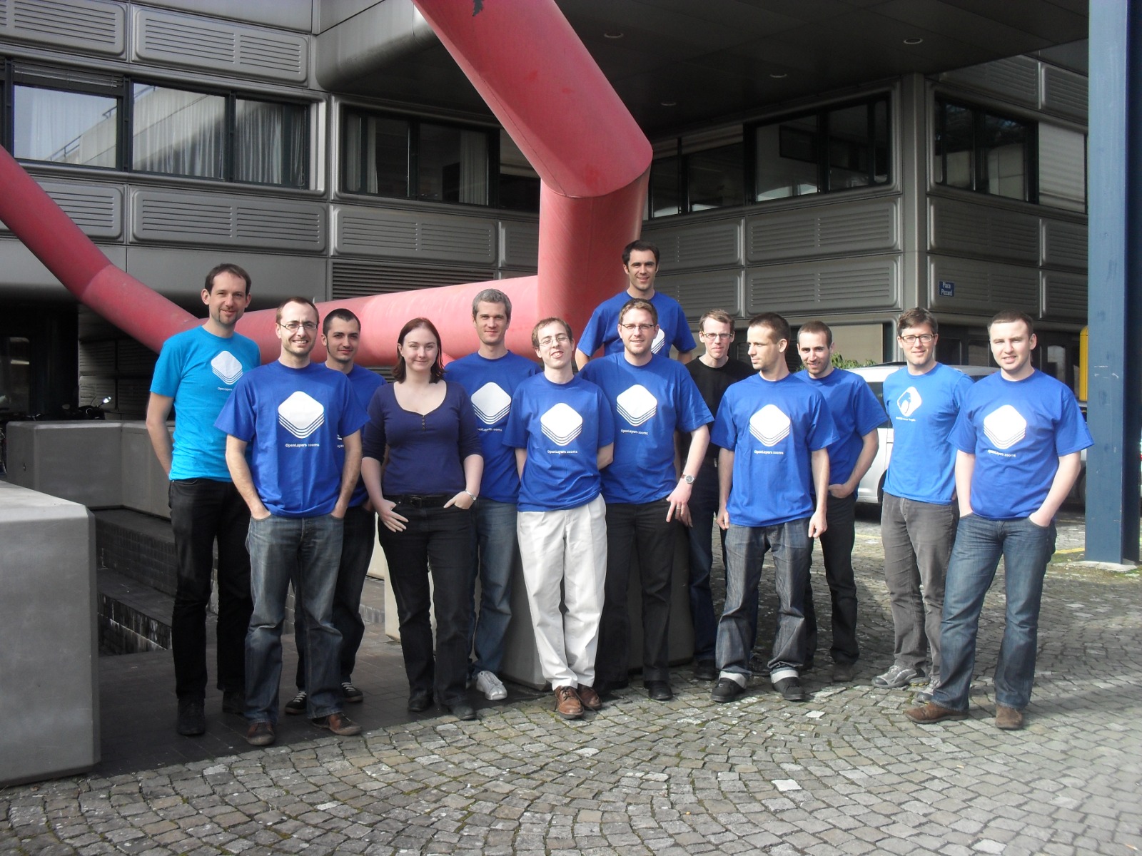
Mobile Sprint 2011

OpenLayers im Browser
Hallo Welt
import 'ol/ol.css';
import { Map, View } from 'ol';
import TileLayer from 'ol/layer/Tile';
import OSM from 'ol/source/OSM';

const map = new Map({
	target: "map", // oder document.querySelector("#map"),
	layers: [
		new TileLayer({ source: new OSM() })
	],
	view: new View({
		center: [0, 0],
		zoom: 2
	})
});
Eine ganze App im Browser
- Vektorkarte von Esri
- Geolocation (z.B. GPS)
- Fotos verorten
- Benutzereingaben laden/speichern
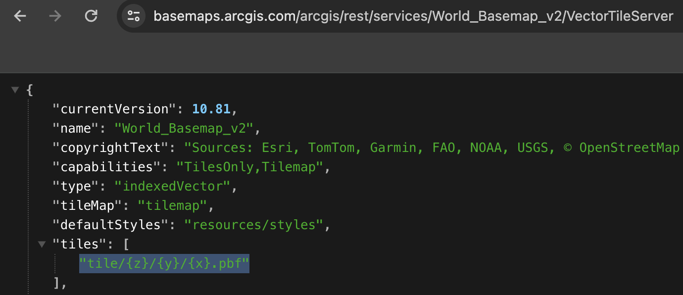
Vektorkarte von Esri
const basemap = new Group();
apply(
	basemap,
	"https://www.arcgis.com/sharing/rest/content/items/659e7c1b1e374f6c8a89eefe17b23380/resources/styles/root.json",
	{
		transformRequest: (url) =>
			url.replace(/\/VectorTileServer$/, "/VectorTileServer/"),
	},
);
map.addLayer(basemap);
transformRequest
- URLs anpassen (für Authentifizierung oder spezielle Anforderungen)
- Esri verwendet HTTP & ReST falsch

Geolocation (z.B. GPS)
const updatePosition = ({ coords: { latitude, longitude } }) => {
	const position = [longitude, latitude];
	positionFeature.setGeometry(new Point(position));
};

navigator.geolocation.watchPosition(updatePosition);
Fotos verorten
draw.on('drawend', ({feature}) => {
	drawnFeature = feature;
	map.removeInteraction(draw);
	uppy.getPlugin('Dashboard').openModal();
});

uppy.on('complete', ({successful: [file]}) => {
	drawnFeature.set('picture', file.uploadURL);
	uppy.cancelAll();
	uppy.getPlugin('Dashboard').closeModal();
});
Benutzereingaben laden/speichern
const markers = new VectorSource();
const format = new GeoJSON();
// laden
if (localStorage.getItem('markers')) {
	const geojson = localStorage.getItem('markers');
	const features = format.readFeatures(geojson);
	markers.addFeatures(features);
}
// speichern
markers.on('change', () => {
  const features = markers.getFeatures();
	const geojson = format.writeFeatures(features);
  localStorage.setItem('markers', geojson);
});
OpenLayers ohne Browser
Beispiele
- Vektorformate konvertieren
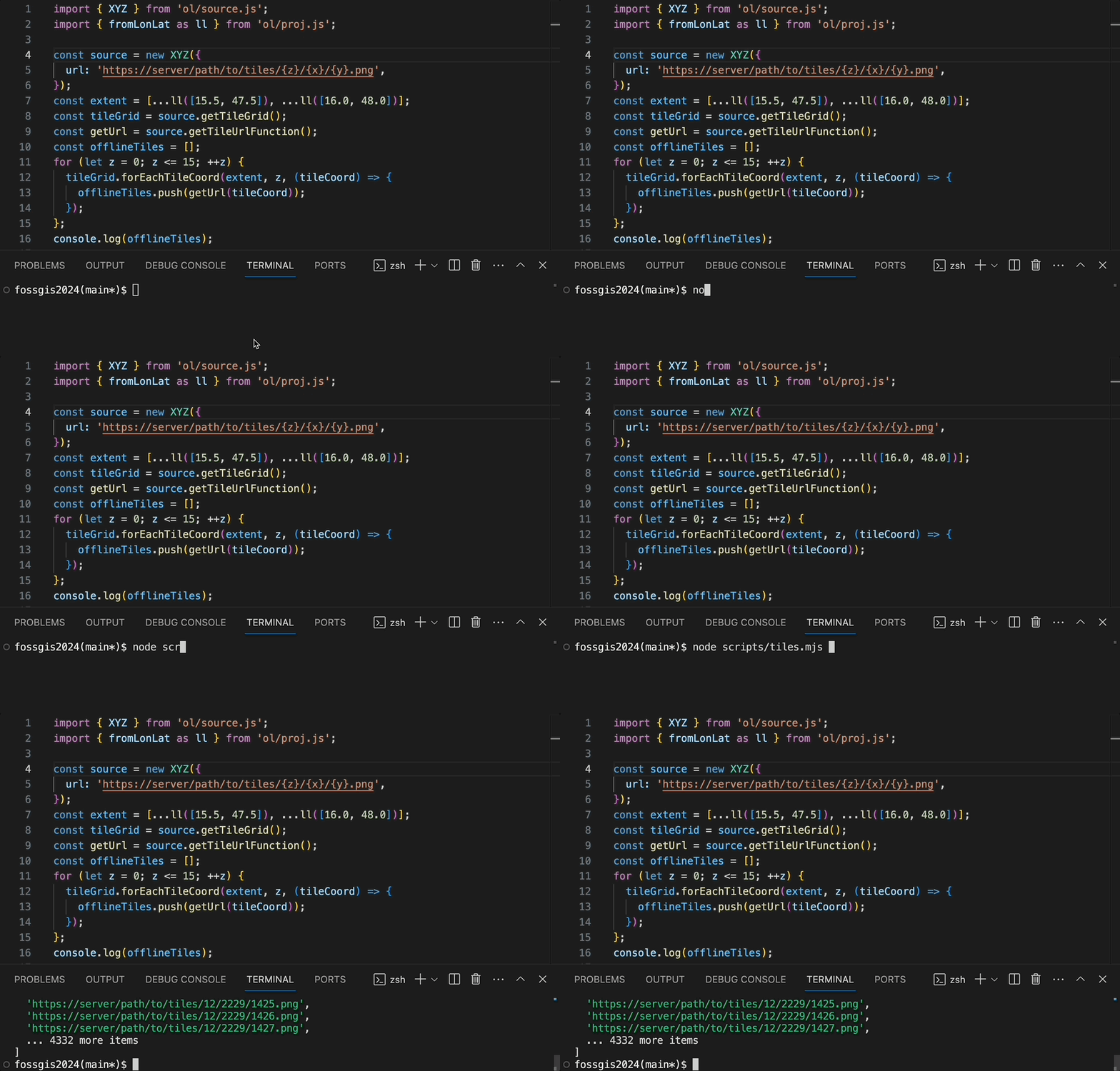
- Offline Karten
- Map Rendering am Server
Vektorformate konvertieren
import { readFileSync, writeFileSync } from 'fs';
import { TopoJSON, GeoJSON } from 'ol/format';

const in = readFileSync('input.topojson', 'utf8');
const features = new TopoJSON().readFeatures(in);
const out = new GeoJSON().writeFeatures(features);
writeFileSync('output.json', out);
Offline Karten

Map Rendering am Server
- Einfache Karten mit jsdom+canvas
- Komplexere Karten mit puppeteer
- Anwedungsmöglichkeiten: PDF-Karten, Thumbnails, ...
- ... oder ein Tileserver!
ol-tileserver
`${baseUrl}tiles/11/1080/662.png?style=${styleUrl}`
z=11, x=1080, y=662, type="png"
const resolution = tilegrid.getResolution(z);
const center = tilegrid.getTileCoordCenter([z, x, y]);
await page.evaluate(
	(center, resolution) => requestMapImage(center, resolution),
	center,
	resolution,
);
result = await page.screenshot({
	encoding: 'binary',
	type,
	clip: { x: 256, y: 256, width: 512, height: 512 },
});
ol-tileserver
zurück im Browser, in OpenLayers
new TileLayer({
	source: new XYZ({
		url: `${baseUrl}tiles/{z}/{x}/{y}.png?style=${styleUrl}`,
		tileSize: 512,
	})
})
ol-tileserver
Ausblick
✨- Keine von großen Firmen vorgegebene Roadmap
- npmjs.com Suche nach
openlayers:
571 packages
Bitte um Mithilfe
- https://github.com/sponsors/ahocevar/
- Pull requests welcome
- https://openlayers.org/
Danke!
Fragen oder Anmerkungen?
Impressum
Autoren & Kontakt
Marc Jansen
terrestris GmbH & Co. KG
Kölnstr. 99
53111 Bonn
Deutschland
jansen@terrestris.de
Andreas Hocevar
w3geo GmbH
Seidengasse 46
1070 Wien
Österreich
ahocevar@w3geo.at
terrestris GmbH & Co. KG
Kölnstr. 99
53111 Bonn
Deutschland
jansen@terrestris.de
Andreas Hocevar
w3geo GmbH
Seidengasse 46
1070 Wien
Österreich
ahocevar@w3geo.at
Lizenz
Diese Folien sind unter CC BY-SA veröffentlicht.


