LayerTree
Tree component displaying the map layers in a hierarchical way
Autoconfigured with the topmost layer group (OpenLayers LayerGroup) of passed map.
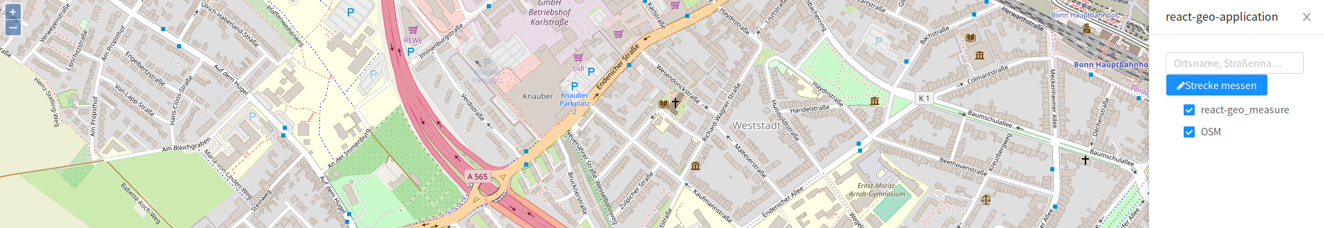 Task: Add a basic LayerTree to the drawer.
Hint: To display the OSM Layer properly, add the name property to the layer variable.
<LayerTree
  map={map}
/>
The layer group (OpenLayers LayerGroup) can be passed as a prop as well.
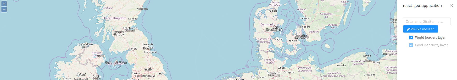
Task: Add the layers Food insecurity layer and World borders layer as a layer group to the LayerTree.
Steps:
- Create the layer group for the three layers
- SRTM30-Contour
https://ows.terrestris.de/osm/service - OSM-Overlay-WMS
https://ows.terrestris.de/osm/service - OSM-WMS (from the previous examples)
- SRTM30-Contour
- Add the layer group to the map
- Extend the LayerTree component with the property
layerGroup
const layerGroup = new OlLayerGroup({
  name: 'Layergroup',
  layers: [
    new OlLayerTile({
      name: 'Food insecurity layer',
      minResolution: 200,
      maxResolution: 2000,
      source: new OlSourceTileJson({
        url: 'https://api.tiles.mapbox.com/v3/mapbox.20110804-hoa-foodinsecurity-3month.json?secure',
        crossOrigin: 'anonymous'
      })
    }),
    new OlLayerTile({
      name: 'World borders layer',
      minResolution: 2000,
      maxResolution: 20000,
      source: new OlSourceTileJson({
        url: 'https://api.tiles.mapbox.com/v3/mapbox.world-borders-light.json?secure',
        crossOrigin: 'anonymous'
      })
    })
  ]
});
<LayerTree
  layerGroup={layerGroup}
  map={map}
/>
Complete Example:
import React, { useState } from 'react';

import OlMap from 'ol/Map';
import OlView from 'ol/View';
import OlLayerTile from 'ol/layer/Tile';
import OlSourceOsm from 'ol/source/OSM';
import OlSourceTileWMS from 'ol/source/TileWMS';
import OlLayerGroup from 'ol/layer/Group';

import { Drawer } from 'antd';

import {
  SimpleButton,
  MapComponent,
  NominatimSearch,
  MeasureButton,
  LayerTree
} from '@terrestris/react-geo';

import './App.css';
import 'ol/ol.css';
import 'antd/dist/antd.min.css';
import './react-geo.css';

const layerGroup = new OlLayerGroup({
  name: 'Layergroup',
  layers: [
    new OlLayerTile({
      source: new OlSourceOsm(),
      name: 'OSM'
    }),
    new OlLayerTile({
      name: 'SRTM30-Contour',
      minResolution: 0,
      maxResolution: 10,
      source: new OlSourceTileWMS({
        url: 'https://ows.terrestris.de/osm/service',
        params: {
          'LAYERS': 'SRTM30-Contour'
        }
      })
    }),
    new OlLayerTile({
      name: 'OSM-Overlay-WMS',
      minResolution: 0,
      maxResolution: 200,
      source: new OlSourceTileWMS({
        url: 'https://ows.terrestris.de/osm/service',
        params: {
          'LAYERS': 'OSM-Overlay-WMS'
        }
      })
    })
  ]
});

const center = [ 788453.4890155146, 6573085.729161344 ];

const map = new OlMap({
  view: new OlView({
    center: center,
    zoom: 16,
  }),
  layers: [layerGroup]
});

function App() {
  const [visible, setVisible] = useState(false);

  const toggleDrawer = () => {
    setVisible(!visible);
  }

  return (
    <div className="App">
      <MapComponent
        map={map}
      />
      <SimpleButton
        style={{position: 'fixed', top: '30px', right: '30px'}}
        onClick={toggleDrawer}
        iconName="bars"
      />
      <Drawer
        title="react-geo-application"
        placement="right"
        onClose={toggleDrawer}
        visible={visible}
        mask={false}
      >
        <NominatimSearch
          key="search"
          map={map}
          style={{
            width: '100%'
          }}
        />
        <MeasureButton
          key="measureButton"
          name="line"
          map={map}
          measureType="line"
          iconName="pen"
          pressedIconName="pen"
        >
          Measure distance
        </MeasureButton>
        <LayerTree
          map={map}
          layerGroup={layerGroup}
        />
      </Drawer>
    </div>
  );
}

export default App;