Measure
The measuring tool is used to measure distances or areas.
Click on the tool to display the two options.

The measurement tool for the desired option can be activated by clicking on the corresponding button.
Distance
- After selecting this option by clicking on it, the mouse pointer changes on the map: it has a point and the user is prompted to draw a line by clicking on the map.
- After the first click, the distance to the first point is displayed on the cursor.
- A double click ends the route and its length is displayed.
- Another click starts a new line, the previous measurement is deleted.
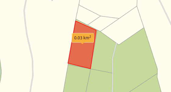
Area
- After selecting this option by clicking on it, the mouse pointer changes on the map: it has a dot and the user is prompted to draw an area by clicking on the map.
- After the second click, the content of the area marked in red is displayed at the cursor.
- A double-click ends the area and its area content is displayed.
- Click again to start a new area and delete the previous measurement.
info
The last measurement is deleted by changing the option or closing the measurement tool.