Tiles and gridsets
Tiles
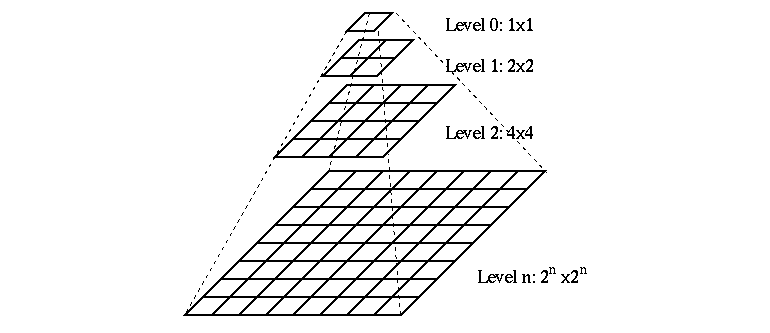
GeoWebCache caches images retrieved from a WMS. The smallest unit of image cached is known as a tile. All tiles are assumed to be the same dimensions and are typically square (i.e. 256 pixels by 256 pixels). The tiles are stored in a rectangular grid, indexed by (x,y) coordinates. A z coordinate (zero-indexed) is used to denote the zoom level, resulting in each tile being indexed as a triplet (x,y,z).
Gridsets
Gridsets and gridsubsets refer to the spatial reference system of the layers served by GeoWebCache. When GeoWebCache makes a request to a WMS, it uses the gridset and gridsubset information to convert its internal tile index to a spatial request that the WMS will understand.
A gridset is a global definition (i.e. not layer-specific) specifying:
- A spatial reference system.
- A bounding box describing the extent, typically the maximum extent for the above reference system.
- One of either a list of scale denominators, resolutions, or zoom levels.
- The tile dimensions in pixels (constant for all zoom levels).
A gridsubset is a layer-specific definition specifying:
- The gridset for the layer.
- (Optional) The bounding box for that layer (which must be a subset of the extent of the gridSet).
- (Optional) A list of zoom levels (which must be a subset of what is defined in the gridSet).
For further instructions have a look at the source of the above explanations, here.
Configure a new gridset
So, our first step will be to create a new gridset:
- Go to
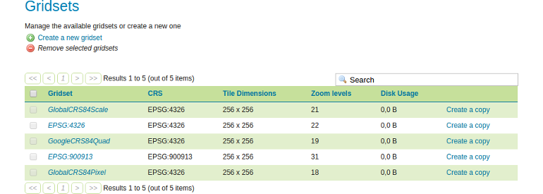
Tile Caching❭Gridsets
- Click
Create a new gridsetto create a new gridset and use the following options for the creation:- Name: momo-4326
- Coordinate Reference System: Use the find-button to select
EPSG:4326 - Gridset bounds: Click
Compute from maximum extent of CRS - Tile width in pixels: 512
- Tile height in pixels: 512
- Define grids based on: Select
Scale denominators
- Click
Add zoom levelto create a new zoom level. Enter the scale300.000.000and the name0. - Once again click
Add zoom level. You will see that the scale value is automatically cut into halves (150.000.000). Just enter the name1and repeat this step until you reached a total count of 8 zoom levels. The last scale value should be2.343.750.
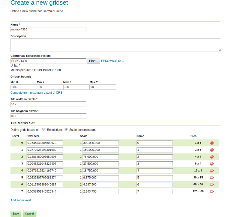
- Click
Save.