Updating a layer
Basically we can change every element of catalog by the use of the REST API. In
the following example we will change the countries_rest layer's default output
projection to EPSG:54009 (Mollweide projection).
Execute the following terminal command to update the layer
countries_rest. (Note: Every update needs the property<enabled>true</enabled>otherwise the catalog entry, in this case the layer, will be disabled and not be visible to any user!)
$ curl \ -v \ -u admin:momo-ws \ -XPUT \ -H "Content-type: text/xml" \ -d "<featureType> <enabled>true</enabled> <srs>EPSG:54009</srs> <projectionPolicy>REPROJECT_TO_DECLARED</projectionPolicy> </featureType>" \ http://localhost/geoserver/rest/workspaces/momo-rest/datastores/db_momo_ws_rest/featuretypes/countries_rest- After this step has been confirmed as successfully finished with
HTTP / 1.1 200 OK, we can then automatically calculate the new native and lat/lon bounding box of the layer by appending the parameterrecalculate=nativebbox,latlonbboxto the REST URL:$ curl \ -v \ -u admin:momo-ws \ -XPUT \ -H "Content-type: text/xml" \ -d "<featureType> <enabled>true</enabled> </featureType>" \ http://localhost/geoserver/rest/workspaces/momo-rest/datastores/db_momo_ws_rest/featuretypes/countries_rest?recalculate=nativebbox,latlonbbox - Review that the layer has been updated correctly by opening the layer
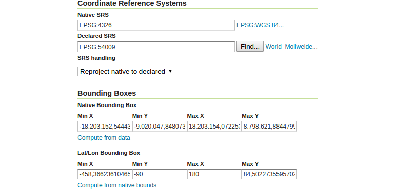
configuration in the GeoServer UI (
Data❭Layers) and have a look at the subsectionCoordinate Reference SystemandBounding Boxes, which should contain your requested changes.
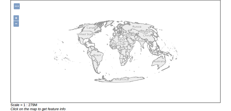
- Finally have a look at the layer preview page and note, that the default SRS is set to EPSG:54009.