Settings
The Settings section involves configuration settings that apply to the entire
server. Again, instead of explaining each checkbox, we'll focus on the most
important administration tools available in this section and its subsections.
For further instructions please have a look at the official GeoServer documentation.
Set handle data and configuration problems
This setting determines how GeoServer will respond when a layer becomes inaccessible for some reason. By default, when a layer has an error (for example, when the default style for the layer is deleted), a service exception is printed as part of the capabilities document, making the document invalid. For clients that rely on a valid capabilities document, this can effectively make a GeoServer appear to be "offline". As administrator you may prefer to configure GeoServer to simply omit the problem layer from the capabilities document, thus retaining the document integrity and allowing clients to connect to other published layers.
Exercise
- Go to
Settings❭Global. - Select
Skipping misconfigured layersin the combo entitled withHandle data and configuration problems in capabilities documents by....

- Click
Submit.
Reduce the number of decimals
To reduce the output size returned in a GetFeature response (and therefore optimizing the bandwith) we can restrict the number of decimal places in a GetFeature response. Here we will set the value to 2.
Exercise
- Go to
Settings❭Global. - Set
Number of Decimalsto 2.

- Click
Submit.
Change logging level
At some point in your production (or development) usage of GeoServer you'll encounter a problem where you'll need to get further and detailed informations to find the cause of the problem. In this case you can increase the level of logging. The following steps will guide you how to set the logging level to a verbose-like level containing valuable informations about the image processing process.
Exercise
- Go to
Settings❭Global. - Select the check box beside
Verbose Exception Reportingto return service exceptions with full Java stack traces. - Find the description field entitled with
Logging Profileand select the profileVERBOSE_LOGGING.propertiesto enable the DEBUG level logging on GeoTools and GeoServer.
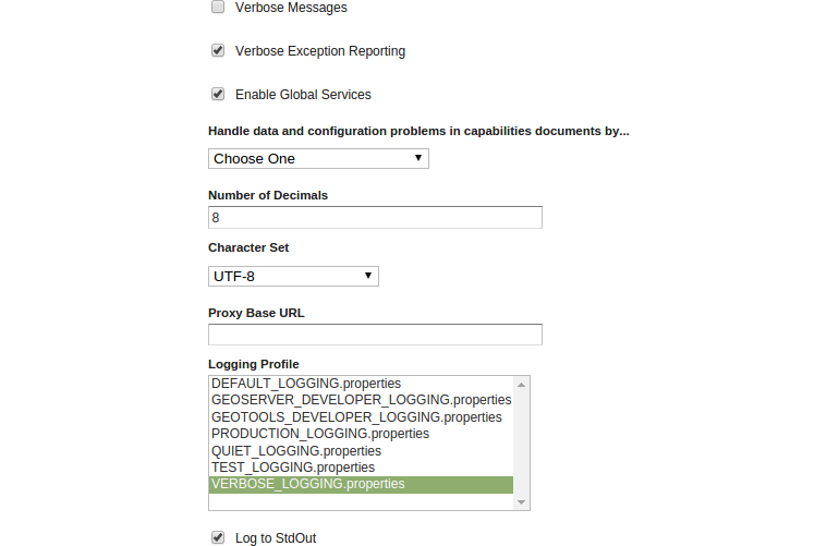
- Click
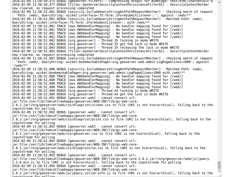
Submit. - To validate the changes please open the OpenLayers layer preview for a layer
of your choice (
Data❭Layer Preview) and zoom slightly into the map. - Go to
About & Status❭GeoServer Logsto open up the logfile and scroll down to the end of the file. Have a look at the timestamp and you'll notice plenty of logs for just a simple GetMap request (you did in the layer preview).
- As the given settings are not really needed for the moment (we aren't facing
any problems) we can reset the logging level to
DEFAULT_LOGGING.properties.